
|
 It fell asleep, or more
precisely dormant... To traverse, it is him to give again the life because its vocation, it was the advance. That of the merchants avernes and Greeks. That of the knights, the pelerins, the hawkers.
Jugglers and troubadours. Salt, spice, wine trail simple like oil and cheeses. But also " strategic " road of tin towards the Mediterranean. Francque knighthood goes from there against the sarrazin.
Of the monk in pelerinage towards Gilles Saint and perhaps the East.A star path in the Milky Way of the voyage which was the Means-Age.
It fell asleep, or more
precisely dormant... To traverse, it is him to give again the life because its vocation, it was the advance. That of the merchants avernes and Greeks. That of the knights, the pelerins, the hawkers.
Jugglers and troubadours. Salt, spice, wine trail simple like oil and cheeses. But also " strategic " road of tin towards the Mediterranean. Francque knighthood goes from there against the sarrazin.
Of the monk in pelerinage towards Gilles Saint and perhaps the East.A star path in the Milky Way of the voyage which was the Means-Age.
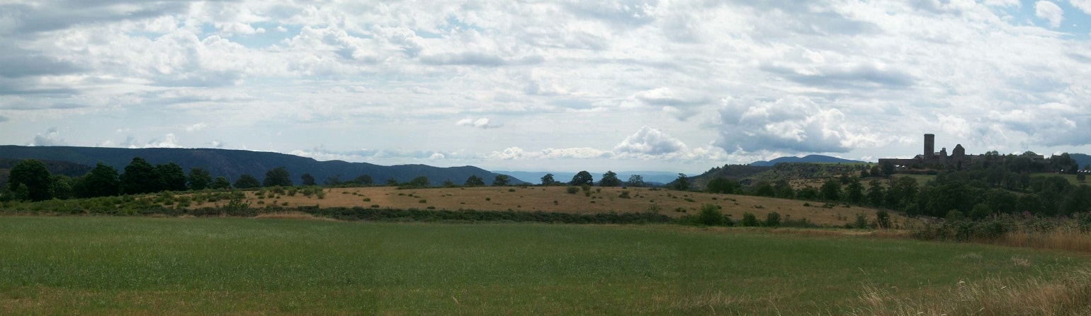
To say of Lozere which it is wedged, it is to want to be unaware of its history or at least to reduce it at the time of the railroads...Lozere, and more still its province of origin Gevaudan, not only was never wedged until the medium of XIXe century but, even, can be regarded as a particularly strong zone of great passages, junctions and roads where kings, hawkers, monks, knights and merchants, herds and charrios intersected intensely. The mobiles of such a circulation was varied, tangled up: monks, economic, military, pastoral; before all it be a zone of contact essential and privilege between a civilization Mediterranean (that it be Greek, Roman or Arab) and and a world Scandinavian, the mysterious country of tin and some dark forest, govern by the people celto-Germanic.
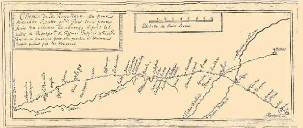
Among the innumerable roads, feel or drailles which still crosses our province, is to us perhaps more particularly near, it is the Regordane way which connected Nimes
to Le Puy en Velay and the country arverne; Mediterranean in the barbarian world of Gaule, even with the regions strange of Brittany and
Ireland.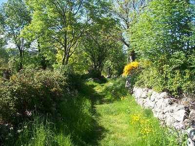 The origin of this way is lost in the mists of
time. Probably way of natural transhumance then pastoral at the time prehistoric, very quickly it grows rich by a circulation by goods at the time Roman between the country arverne and that of
Volques centered around Nemausus (Nimes): wine counters weapons and jewels; oil and salt counter wheat and cheeses... with the progression of rolling, maintenance then the widening of the roadway
system organizes... tolls and " protections " also because the country is not very sure and this circulation of rich nesses crams, especially those which constitute the Eastern products (silk trade,
spices) arrived by the wearing of Saint Gilles and going up towards the famous Champagne fairs. Places of meet, of exchange are constituted, starts cities and boroughs which we know today: Chamborigaud, Genolhac, Langogne, Villefort, stages, shelters, warehouses of a trade which enriches the bordering populations. Fortresses appear, the such castle of Gates like La Garde-Guerin which protect (or oppose) these economic but so cultural currents.
The origin of this way is lost in the mists of
time. Probably way of natural transhumance then pastoral at the time prehistoric, very quickly it grows rich by a circulation by goods at the time Roman between the country arverne and that of
Volques centered around Nemausus (Nimes): wine counters weapons and jewels; oil and salt counter wheat and cheeses... with the progression of rolling, maintenance then the widening of the roadway
system organizes... tolls and " protections " also because the country is not very sure and this circulation of rich nesses crams, especially those which constitute the Eastern products (silk trade,
spices) arrived by the wearing of Saint Gilles and going up towards the famous Champagne fairs. Places of meet, of exchange are constituted, starts cities and boroughs which we know today: Chamborigaud, Genolhac, Langogne, Villefort, stages, shelters, warehouses of a trade which enriches the bordering populations. Fortresses appear, the such castle of Gates like La Garde-Guerin which protect (or oppose) these economic but so cultural currents.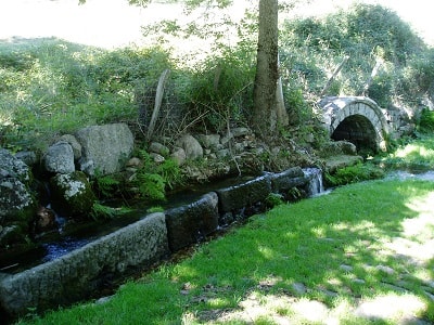
Because quite naturally, the Regordane way becomes in more one road of pilgrimage. If the inns flower, the places of worship also and its sets of relics whose our Average Age has the so delicious secrecy. Just to North, towards Puy, passes the path of Jacques Saint. That of Teutons, which drains all North East of Europe towards the Marial Sanctuary of Le Puy en Velay. Carrefour for Jacquets and others pilgrims which by Regordane will offer a descent towards the large Monastery of Gilles Saint and his port to the many destinations.
Path religious, tourist, cultural also where ribaudes and feast, trouvere and chanson de geste enamel a pilgrimage somewhat " longuet ".The hotel of this time look after already the greeting and be unaware of not the animation... the account warlike of crusade (and one know that towards the South and the Spain, the crusade be largely former with Cross) offer a support of dream and some history with long night of mythical valley Cevennes.
It is necessary to follow the Regordane way, to discover its ancestral paving, which they are Roman or "François". It is necessary to observe under the vegetation the ruts left in the rock by the carriages heavily charged with mysterious food products to the dubious destinies; these boroughs and these porches considerable which swallowed at the falling night horses and mules, bundles and hawkers to restore them the morning in the sunny freshness of the colors, the rumors, the odors...
It is necessary, with the length of our tour, in the many traces which left our parents of this time, knowledge to read their concern, their hopes, their myths. Guilhem with the court Nes, Fierbrace is always there, present and irons of its destrier still resound on the ancestral flagstone. He which borrowed Regordane starting from Le Puy en Velay to take again Nimes in Sarrazins. Felons which (in true God do not believe nor in Dame Marie). They thus deserve an exemplary punishment:
Vestent hauberz, lacent hiaumes gemez
Ceingnent espees a ponz d'or noielez
Montent es seles des destriers atrivez;
A lor cops pendent lor forz escus bouclez,
and en lor poinz les espiez noielez.
De la vile issent et rengie et serre
Devant els font l'oriflanbe porte
Tout droit vers Nymes se sont achemine.
A tot dis mille de François bien armez
qui de bataille estoient aprestez...
Par mi forez et par bois chevauchierent
Par Ricordane outre s'en trespasserent,
De si au Pui onques ne s'aresterent...
 Ten thousand knights on
Regordane? the path lived its hours of glory. Would too much prosperity, out of joy kill? Would a thousand-year-old history be inserted in the lapse of memory? Like always alive Merlin with the lady
of the lake, the memory of Regordane laps gently under the water's surface. As at the end of XIVe century when the Hundred YearsWar made us forsake our territory, time has made
us lose the Regordane. The valley of the Rhone and the honest fairs of Lyon will come again. Re-appearing in XVIIIe century from the royal will, it sparkles again because
its life is elsewhere.More nothing? Ruins, brousailles, paving, a path. It is here, it is there... But does it hold prisoners on the sides of the sirens? The music is still
there. Perfumes and sonnailles have not finished telling its innumerable legends. And the disjoined paving stones sing deaf an old song.
Ten thousand knights on
Regordane? the path lived its hours of glory. Would too much prosperity, out of joy kill? Would a thousand-year-old history be inserted in the lapse of memory? Like always alive Merlin with the lady
of the lake, the memory of Regordane laps gently under the water's surface. As at the end of XIVe century when the Hundred YearsWar made us forsake our territory, time has made
us lose the Regordane. The valley of the Rhone and the honest fairs of Lyon will come again. Re-appearing in XVIIIe century from the royal will, it sparkles again because
its life is elsewhere.More nothing? Ruins, brousailles, paving, a path. It is here, it is there... But does it hold prisoners on the sides of the sirens? The music is still
there. Perfumes and sonnailles have not finished telling its innumerable legends. And the disjoined paving stones sing deaf an old song.
Enveloping and eternal are its shores. And its mirages which lead nowhere safe at the end of our dreams.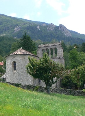 The priest's journey Aulanier du Brignon on de Regordane way in the XVIIe
century.
The priest's journey Aulanier du Brignon on de Regordane way in the XVIIe
century.
16 november 1644 : de bon matin (start) pour le voyage de Nisme en Languedoc disner à Pradelles où despense 16 sols; à Pranlas un picotin pour ma cavale et collation : 5 sols 6 deniers et souper et
coucher à la Bastide, au logis des trois rois, 23 sols.
17 november : partis à l'aube du jour de la Bastide, fus disner à Villefort au logis des trois rois, despense 17 sols 6 deniers; collation et picotin à Genolhac, 4 sols 6 deniers; souper et coucher
au Pradel chez le logis appele Fornier, despense 19 sols 9 deniers.
18 november : parti du Pradel au lever du jour, l'Abbe Aulanier dine à la Lege d'Alais où il depense 23 sols 3 deniers pour lui et son cheval; il fait collation et donne l'avoine à la Barraque de la
Bitarelle où 9 sols 6 deniers sont depenses; et enfin il arrive pour souper et coucher à Nismes ce qui lui coûte 25 sols 9 deniers compris 2 sols au port.P. Grelet de la Deyte,
at the end of de XVIIe century, has been traveling between le Puy and Montperlier:
« Jey fait deux voyages en la ville de Montpellier . savoir au mois de juin de l'annee 1681 et l'autre au mois de janvier 1692. Pour y aller il faut passer du Puy à Bisac, à Costerot, à la Sauvetat,
à Pradelles, à Langonhe, à Luc, à Pranla, à Regletout, à la chapelle Saint Thomas, au Tord, à la Molete, à La Garde-Guerin, à Bayard, à Villefort, à Viluy, à Genoulhac, à Chamber Rigau, à Porte, au
Pradel, au Maviau, à Saint Martin, à la ville d'Allex, à la Taverne, auquel lieu il faut passer la riviere du Gardon, à Ladinghan, à Crepian et à la chapelle, à la ville de Soumiere, à Formaingnhe,
au Pont Neuf et à Montpellier. D'icy à Montpellier il y a environ 35 lieux. » PAYRARD, J.B. Petites ephemerides vellaviennes. 1889, Le Puy en Velay. " Le livre de raison de
Louis Jouve " dans Bulletin historique et scientifique de l'Auvergne. Tome XXXIII, n°603, 1964.0lder than mankind
Millions of years later, early man followed them, creating a simple path. Some historians suggest that by Phoenician times it was used as part of a convoy route for tin, from the Normandy port of Saint-Valéry-en-Caux to the Mediterranean. Certainly, the Romans used it to move metals around, but it was in the Middle Ages, after the Carolingian Empire broke up, that it became a major trunk route. The Rhône valley became part of the Germanic Empire, and GR®700 Voie Régordane (Regordane Way) then became the easternmost trunk route in France.
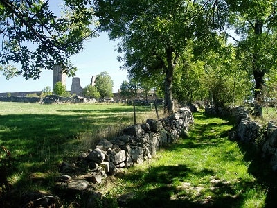
 By now, man had developed carts drawn by animals, allowing much heavier loads to be moved. The trail changed from a single file footpath to a track with two ruts about 1.4
metres apart. If you follow the path southwards from La Bastide-Puylaurent you can still see these ruts in the ancient schist of the Thort plateau. At Génolhac you will also see vestiges of the gothic arches of the entrances to village houses which were built over the vast warehouses used to store produce
along the route.The track known as ‘GR®700 Voie Regordane’, which connected ancient France (today’s
Ile-de-France, Paris and the surrounding region) with the Languedoc, runs from Le Puy-en-Velay in the Cévennes to Saint-Gilles on the edge of the Camargue.
Strictly, it should be called ‘le Chemin de Régordane’ – the name ‘Regordane’, implying ‘Via’, a Roman road, appeared in the 20th century.
By now, man had developed carts drawn by animals, allowing much heavier loads to be moved. The trail changed from a single file footpath to a track with two ruts about 1.4
metres apart. If you follow the path southwards from La Bastide-Puylaurent you can still see these ruts in the ancient schist of the Thort plateau. At Génolhac you will also see vestiges of the gothic arches of the entrances to village houses which were built over the vast warehouses used to store produce
along the route.The track known as ‘GR®700 Voie Regordane’, which connected ancient France (today’s
Ile-de-France, Paris and the surrounding region) with the Languedoc, runs from Le Puy-en-Velay in the Cévennes to Saint-Gilles on the edge of the Camargue.
Strictly, it should be called ‘le Chemin de Régordane’ – the name ‘Regordane’, implying ‘Via’, a Roman road, appeared in the 20th century.
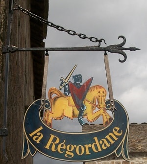
For many people, the favorite way to sample le Chemin de Regordane is to start with a night at a guesthouse called L’Etoile (Star) in the village of La Bastide-Puylaurent. If you take a quick look at the English version of their web site, you’ll understand why.
In the evening, sample a meal accompanied by home-made bread, spring water and wine from the nearby monastery of Notre Dame des Neiges. On 26 October 1878, Robert Louis Stevenson stayed at the monastery – you can read an evocative account in his book ‘Travels with a Donkey in the Cévennes’.
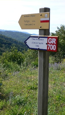
Somewhere between 7:30 and 9:30 the next morning (depending on the sort of person you are), sample some more home-made bread, with honey, as part of your breakfast. Now you are ready to set out on the Cévenol section of le Chemin de Régordane, which passes through the village a mere 100 metres away. You can get a good feel for it by walking as far as La Garde-Guerin or Villefort – or if you are a dedicated trail follower you can go all the way to the Mediterranean, stopping off in gîtes on the way, and perhaps taking side trips to any of a score of fascinating places which I’ll describe in other articles. (How about pedalling your way along a railway line on a modified version of the old hand-driven trolleys used for track maintenance?)
The Chemin de Regordane takes its name from the ancient Province – la Regordana – through which it passes. This Province corresponded approximately to the area enclosed by the towns of Ales, Pradelles and Largentière. The section we will follow starts on the high volcanic plateaux of Le Thort, La Molette and Garde-Guérin, then it is cut out of the schist slopes of the Ceze Valley. In the 12th and 13th centuries, developments in harness design led to carts drawn by teams of animals (typically oxen), but they were still limited to loads of about 500 kilos (half a tonne) because of the way they were constructed. In the second half of the 12th century, the epic poem ‘Le Charroi de Nîmes’ talks of the pays de Regordane and its profusion of carts: "… char et charettes i a à grant planté…”.The reason was the climate of the time, which was similar to the one it enjoys now. Vegetable crops were abundant, and some of the resulting wealth was used to build the cathedrals we still admire.
 In the 14th century, the climate became cold and damp,
malnourishment became common, and bubonic plague halved the population while the Hundred Years’ War devastated the country.The carts disappeared and the tracks degenerated. Traffic was reduced
to convoys of mules some of which, carrying silver and saffron, fell victim to bands of English robbers. It was only towards the end of the 17th century, triggered perhaps by the King’s concern
over the Protestants of the Cévennes, that le Chemin de Régordane came back to life.Maintaining it was a never-ending task. Swollen streams from the early autumn storms quickly eroded the gravel
surface, and often did more serious damage.
In the 14th century, the climate became cold and damp,
malnourishment became common, and bubonic plague halved the population while the Hundred Years’ War devastated the country.The carts disappeared and the tracks degenerated. Traffic was reduced
to convoys of mules some of which, carrying silver and saffron, fell victim to bands of English robbers. It was only towards the end of the 17th century, triggered perhaps by the King’s concern
over the Protestants of the Cévennes, that le Chemin de Régordane came back to life.Maintaining it was a never-ending task. Swollen streams from the early autumn storms quickly eroded the gravel
surface, and often did more serious damage.
La Côte de Bayard, the section between Villefort and La Garde-Guérin, needed to be rebuilt completely every ten years. It used to zigzag directly up the slope above the village of Bayard, but in the middle of the 18th century it was abandoned and replaced by a long diagonal route across the slope below La Cham Morte. This is the ruined track you take today, showing the remains of paving which may look Roman but was built during the First Empire.The new traffic dug narrower ruts – about 1.2 metres apart.
The carts, copied from those currently used in the Velay, were narrower than the Roman ones although they carried greater loads.But the 19th century brought accelerated progress. Horses were more powerful than oxen, and it was more efficient to build roads on which they could trot rather than walk. The result is the modern road, with about 650 bends between Alès and Pradelles. Now even the drivers of heavy trucks find this frustrating and even dangerous - they would rather have a steeper straight road. Maybe one day they’ll get it, and hikers will have a new trail at their disposal. by Mike K-H
 |
GR®700 Regordane Way
History of the Regordane Way
Pictures of the GR®700 Regordane Way
GR® Long Distance Footpaths
Private parking at L'Etoile Guest house (La Bastide-Puylaurent) during your hike
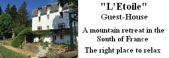
Former holiday hotel with a garden along the Allier, L'Etoile Guest House is located in La Bastide-Puylaurent between Lozere, Ardeche, and the Cevennes in the mountains of Southern France. At the crossroads of GR®7, GR®70 Stevenson Path, GR®72, GR®700 Regordane Way, GR®470 Allier River springs and gorges, GRP® Cevenol, Ardechoise Mountains, Margeride. Numerous loop trails for hiking and one-day biking excursions. Ideal for a relaxing and hiking getaway.
Copyright © GR®700-regordane.com